Warrumbungle Summits Adventure - the story, the lessons, the adventure!
by Jo Bradshaw.
The long-awaited adventure to the Warrumbungle National Park in northern NSW had finally arrived - but before we started we had already pivoted, with Coach Michele unfortunately unable to join us. We all very much appreciated the rearranging Clare had to do to be able to join us.
Coach Clare steps up big time!
And so the adventure began with lots of learning lessons to come.
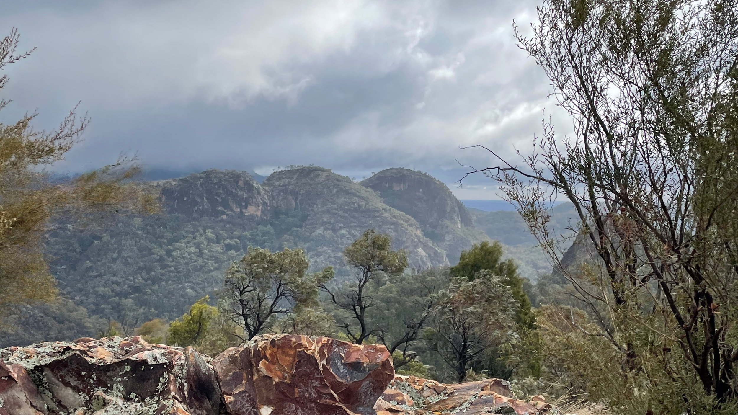
The Warrumbungle Mountain Range
DAY 1
After driving through the NSW countryside for 6 hours, we turned towards Warrumbungle National Park from Coonabarabran. As we neared our destination, we were greeted by a huge stone mountain suddenly rising from the plains & this was just the beginning. Driving further into the park, we were entering a world millions of years old, formed from volcanic activity.
We were on Country of the Gamilaraay people. A culturally significant area for the indigenous as this was the gathering place of 3 tribes – Gamilaraay, Wayilwan & Wiradjuri. A place to come to meet, share & respect.
The area is also Australia’s first Dark Sky Park. This area is internationally renowned for its crystal clear night sky, low humidity & high attitude. It is also home to the world-class astronomy research facility at the nearby Siding Springs Observatory.
10 Diamonds, with cars packed to the brim, arrived at Camp Walaay after driving for 6-7 hours to be greeted by the smiling faces of our leaders, Jo & Clare. We had a laugh on the way when, in our What’s App group, a message came through from Julie “Wow there is a lot of dirt road” Clare “Might want to check your GPS, there shouldn’t be any dirt road”. Weekend lesson #1 Google maps don’t recognise road surfaces & cannot be trusted.
A detour on dirt!
After setting up camp (hoping we would be warm enough) we spent time getting to know our fellow Diamonds- especially remote Diamond Marie-Claire.
Setting camp.
Marie-Clare
Thursday night gave us a chance to experience the fine Diamond cuisine that was to continue all weekend. The first meal of Moroccan Chicken & 2 huge bowls of Couscous Salad (that kept giving all weekend) & Apple crumble, had all of us wanting the recipes.
Fabulous fuel for hiking!
Michele had organised the food for the weekend and Clare was designated head chef. We had gourmet hamburger night with sticky date pudding, Mexican burritos and Baklava and all sorts of treats, lunch packs and a BIG brekky fry up on departure morning. There was no way we were going to go hungry. After a briefing by Jo on what the plan was for tomorrow, we all went off to bed excited to hit the trails in the morning.
Dinner by campfire.
DAY 2
Friday morning broke & thankfully we had all survived overnight. After breakfast, we made our wraps for lunch (yes there was couscous salad) & gathered up our lunch boxes complete with snacks, fruit & a popper juice. We carpooled for the 5-minute drive to the Pincham carpark to start the Day 1 adventures.
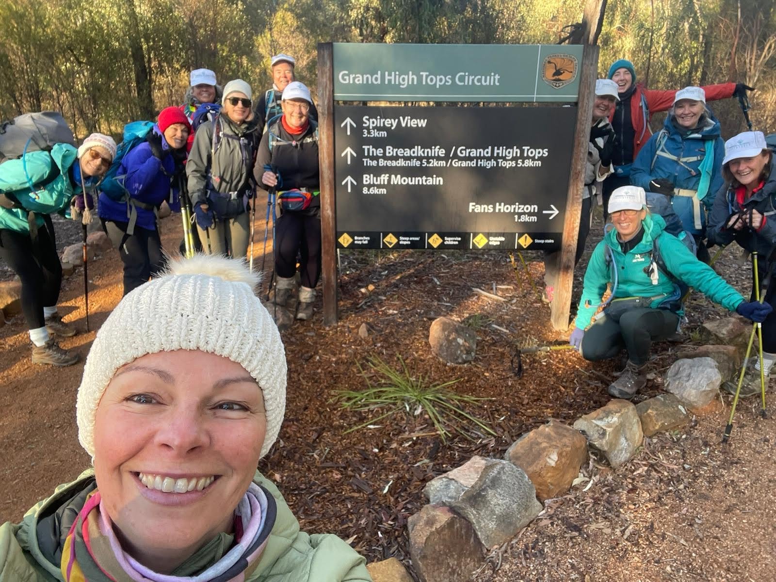
Pincham - ready to go!
We would be taking the West Spirey Track to Mount Bluff (our first summit of the weekend) via Ogma Gap & Dow Camp. We would then be continuing across & back down to the carpark – or so we thought. But Mother Nature had other plans.
Never underestimate the mountains!
A quick weather check saw us donning raincoats & pack covers in preparation for a “little rain”. Setting off, the weather looked promising but soon we had heavy raindrops that were bouncing off the track – oh wait they were actually small hail stones. This was short-lived though & we continued on, taking in changing scenery as we head upwards anticipating the views we would encounter as we rose higher. We were soon warming up & a delayering stop was taken.
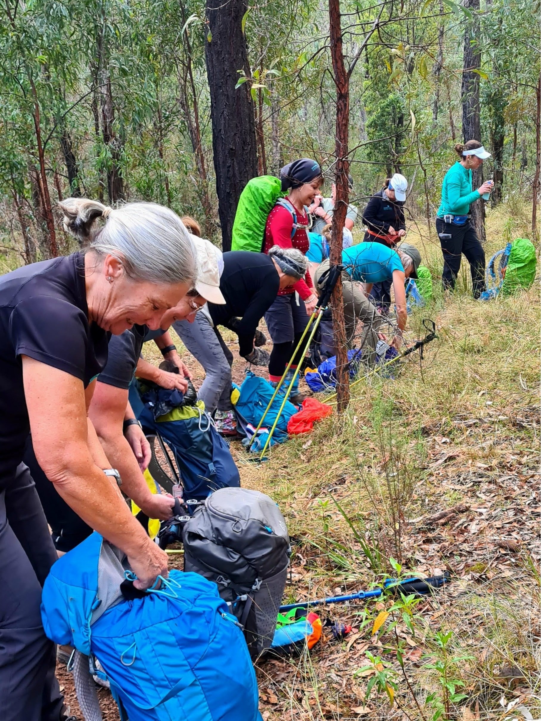
Gear on, gear off, gear on…
Off we set again, enjoying the conditions which were great for hiking. Suddenly though we stopped again to relayer, bringing out the raincoats again, as conditions became cold & windy. Carefully we continued our ascent as the rain began & visibility dropped as we literally were walking in the clouds. We all were hoping that it was passing and would clear soon.
Into the clouds!
We made it to our morning tea stop, taking shelter under the trees in Dow Camp at the base of the Bluff Mountain track. Here we pulled out whatever gear we still had in our packs – gloves, beanies, rain pants & had a quick snack. Lesson #2 rain pants are of no use when they are in your tent at camp & gloves are a lifesaver.
The importance of being prepared for anything!
Jo & Clare reassessed the route and following the DITRA code of ‘Accepting the Unexpected’, the plans changed. We would do parts of our 2nd day route today & see what we could fit in tomorrow. So we continued along the trail, heading for Balor Hut where we could have a much need hot drink under the shelter of an awning (yay out of the rain) & a drop toilet.
Balor Hut
The chatter of the group had quietened, as we concentrated on every step & dreamt of a warm drink. Lesson #3 Miso soup is a great warmer in cold weather. After a refuel, we headed along the trail passing 2 other groups on the way until we came to the top of a staircase, a very long wooden staircase. It was very wet & we each tentatively took the steps one at a time. The park has done a lot of work to make access easier & protect the environment.
A long stair descent and out of the clouds.
As we came down the path, we could occasionally see the rocky outcrops as the cloud swirled in and out. The lower we came the less wind and rain there was. As we headed downhill Jo had another big surprise for us. We were going back up hill, first to Spirey View Lookout. On a clear day, this gives you a view of the famous Breadknife (and not so famous Diamond named Butterknife) but as we held our breath waiting for the cloud to clear, it didn’t happen. We had to be happy with half a Breadknife.
The Breadknife - 90m of narrow volcanic rock
Back down onto the main track for a short time, we turned off & headed up to Macha Tor. We headed to the base of the scramble to the top of Macha Tor & found a spot to take some time off our legs & enjoy our lunch before we headed to the top.
A sheltered spot to refuel and rest!
We carefully climbed, keeping a good distance between each other in case of falling rocks & made it to the top. Here we were greeted with the type of views we had been waiting for & a howling wind.
The ascent to Macha Tor - a small volcanic plug at 743m
Out came the Diamond Banner & in between wind gusts, we took our positions for the photo & then retreated carefully back down to our packs below.
So much fun!
The challenging part of the day was over & we made our way back towards the carpark, dreaming of the hot shower & warm, dry clothes that awaited us at camp.
A careful descent.
Our first full-day hike was done with a distance of 16km & 758m elevation gain & a very important Lesson #4 conditions can change very quickly & you need to be prepared for all seasons – always.
Michelle & Clare
Back at camp warm & dry, Jo led us through some standing stretches to help ease our aches & pains. After dinner (again super tasty) & clean up was completed, we were all ready for a good sleep & hoped that tomorrow we would see the views we had all come for.
Camp kitchen
DAY 3
What a difference a day makes!
Saturday dawned clear & dry but we had learnt yesterday in Lesson #5, camp & track conditions are not always equal. We were disappointed though that Michelle had made the hard decision to not come today as her knee was not good & she didn’t want to make it worse.
Day 2 at Pincham - cold but no sign of hail!
We made our lunch (yes there was still Couscous salad), packed our lunchbox and headed back to Pincham carpark. Today we were going in the opposite direction to yesterday, which meant we would be climbing up the wooden staircase. I’m not sure about the others but I know that was in the back of my mind as we headed up past the turn-offs to Macha Tor & Spirey View. We slowly climbed at our own pace till we all were at the top of the stairs.
Trek Training put to the test.
Retracing our steps from yesterday past Balor Hut we arrived at the Grand High Tops turn-off, a short 630m track according to the signpost. But don’t be fooled by the distance as it was a narrow rocky track that we carefully climbed until we arrived at the sight we were all waiting for, The Bread Knife in all its glory, rising 90m skywards, set against the brilliant blue sky.
A tricky climb
Looking down at The Breadknife
Out came the Diamond Banner & our second summit photo was taken before we refuelled, taking in the million dollar views on multiple sides. Wow, what a difference a day makes.
Grand High Tops Summit!
We headed back down to the main track & continued on towards Mount Bluff. Stopping at Dows Camp, Jo told us we had time to summit Mount Bluff, so the team decision was made we would go for it.
Loving the rocks!
Another hard uphill trek, taking in a variety of foliage including an avenue of gorgeous grass trees. Nearing the top we were greeted by first the smoky smell & then the blackened area of a fire but we still weren’t to the top.
Bluff Mountain ascent - evidence of recent burnoff
The next section was rocky & narrow in some places. We could see others in the distance at the top and wonder how we would get up to where they were.
My ‘I can sense a summit coming on’ face!
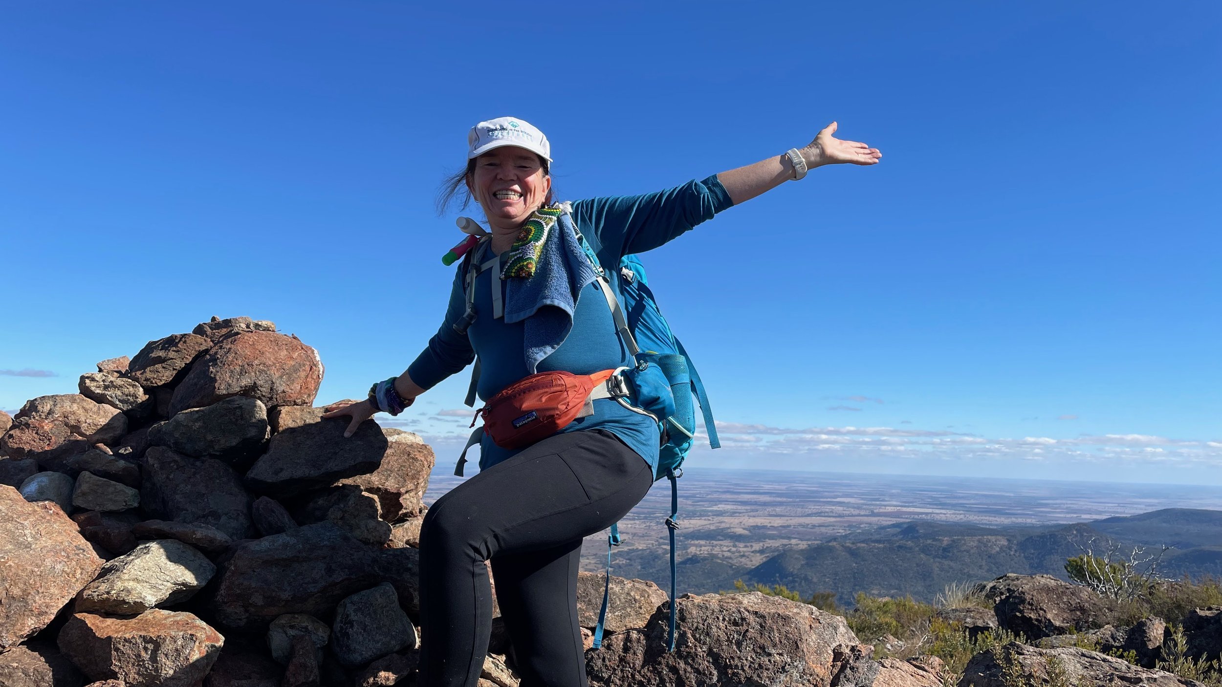
Another 10 minutes passed & we were there. Summit 3 conquered.
Oh what a feeling!
Out came the Diamond Banner, photo taken & then we all found a spot to have lunch, soaking in the 360-degree views. All around us, we could see the forested ridges, barren spires & deep gorges that make up this vast park.
In the distance, we could see the plains that went for miles.
Lunch spot on the summit.
It was mostly all downhill from here, albeit a steep downhill. It was only as we came down the track, that yesterday we couldn’t see anything from, did we realise how high up Mount Bluff was. The lower we got, the higher it got.
The descent
Would we have attacked it with such gusto yesterday if we had seen how high it was, maybe not.!!
We can’t believe we climbed to the top of this - Bluff Mountain from the home trail.
We quietly made our way back to the carpark, quietly processing just how much we had done today. 17km & 907m elevation gain.
Every step through the beautiful Grass Tree trail!
Once back at camp, we made record time to get ready to go into Coonabarabran for our Stargazing experience.
Clare prepared dinner while we showered & layered up for the cold night ahead. We ate, washed & cleaned up & were on the road in 2 hours. Fiona & Michelle volunteered to drive & we were all on wildlife lookout as we made our way to town.
Always a roaring fire to greet us.
We arrived at the caravan park & took our seats around the telescope not really knowing what to expect.
The telescope
Our guides were very enthusiastic as they pointed out the Southern Cross, Field of Diamonds, Jewel Box, Dark Emu & many other wonders of the night sky. We ended the night admiring the half moon & going home with pictures on our phones of it, how cool.
The moon through the telescope.
Sunday morning saw us having a sleep-in before we packed up our gear while Clare again prepared a tasty big breakfast cook-up for us. We cleaned up for the last time & said our goodbyes.
A quiet Sunday morning in camp.
Our adventure was over but the memories will last. We had made new friends, learnt many lessons, hiked all seasons in 2 days, and completed all that had been planned although not in its original order.
A huge thank you to all the coaches involved for making this a fantastic Diamond Adventure. Michele for all the hard work put into organising our delicious food (we will be waiting for the recipes), Jo for the track knowledge & keeping us all in check whilst on the trail (not an easy task) & Clare for stepping in on short notice (not an easy task for a mum with 2 children).
Jo B (author)


